- Thumbnail
- Resource ID
- eb7458c4-905b-11ea-ae3c-06760a0009eb
- Title
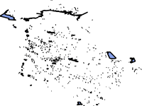
- Wetlands of Albania
- Date
- April 24, 2020, midnight, Publication
- Abstract
- The geospatial dataset has been produced by Gjelberimi 2000 sh.p.k . Wetland detection was based on existing wetlands identified sites as per the National Reports (September 2005 - November 2011). The delineation of final wetland polygons was performed by computer-based photo interpretation using Google's (hybrid) cartographic background. The polygons represent the boundaries of wetland ecosystems covering all wetland types, as those are defined by the Ramsar Convention.
- Edition
- --
- Owner
- NEA
- Point of Contact
- Purpose
- --
- Maintenance Frequency
- unknown
- Type
- vector
- Restrictions
- otherRestrictions
- The responsible organization for the quality of the data is National Environental Agency, Ministry of Tourism and Environment of Albania.
- License
- Not Specified
- Language
- eng
- Temporal Extent
- Start
- --
- End
- --
- Supplemental Information
- No information provided
- Data Quality
- The responsible organization for the quality of the data is National Environental Agency, Ministry of Tourism and Environment of Albania.
- Extent
-
- long min: 5088229.593300000000000
- long max: 5256370.760200000000000
- lat min: 1902797.164600000000000
- lat max: 2213854.999500000000000
- Spatial Reference System Identifier
- EPSG:3035
- Keywords
- no keywords
- Category
- Environment
- Regions
-
Europe
,
Albania